
ALTA - NSPS Land Title Surveys

What are ALTA - NSPS Land Title Surveys?
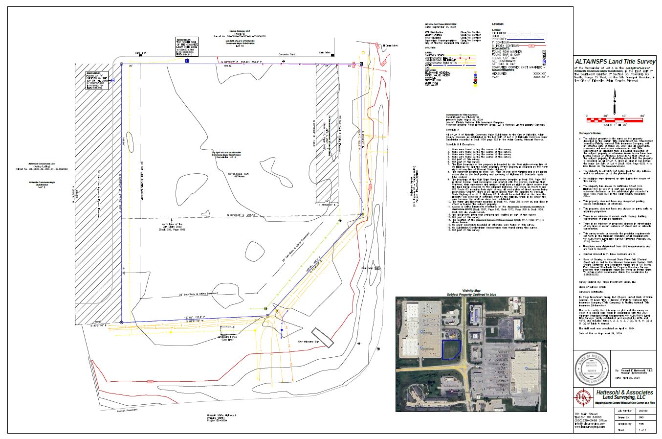
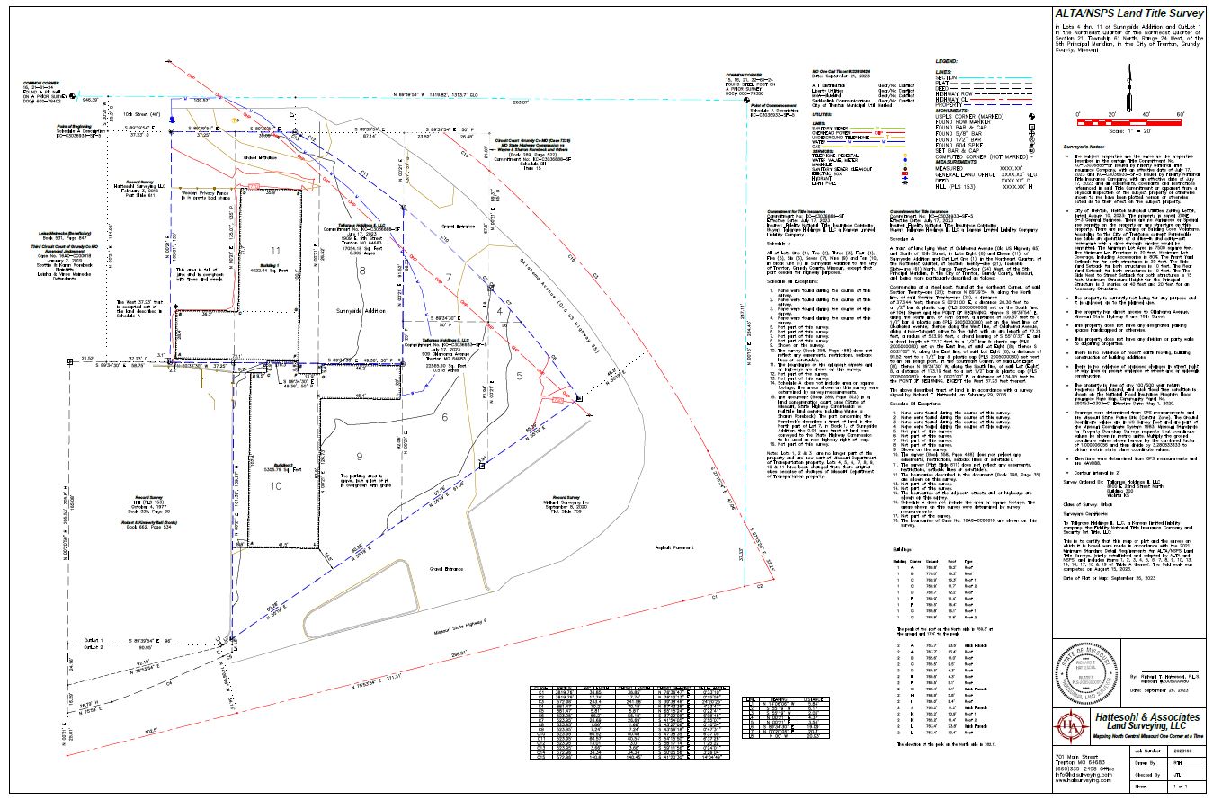
ALTA – NSPS Land Title Surveys are the most comprehensive type of survey and improvement location. It covers all aspects of the boundary survey and improvement location and identification of any additional evidence of possession or use, which could be adverse to the interests of the purchaser. This type of survey is normal only performed on commercial property because of the expense involved.
ALTA/NSPS Land Title Surveys
Are used by members of the American Land Title Association whom have specific and stringent requirements when asked to insure title to land. An ALTA/NSPS survey is performed to disclose all that which might be discoverable from survey and inspection of the real property. High accuracy standards and detail requirements are demanded of the surveyor performing such a survey not just with measurements in the field but also during a thorough inspection of the real property title report.
Visit www.ALTA.org for more information.